
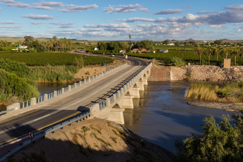


The Northern Cape of South Africa is a lush, green region split into innumerable channels of islands of varying length by the Orange River, the country’s longest river. Linking the communities of the Orange River Basin region together are three dilapidated arch bridges that lie across the lower part of the region near the town of Keimoes. Constructed during the Great Depression with labor-intensive methods using local materials to enhance employment within the local community, the 77-year-old Grobler’s Bridges were due for an upgrade by 2008.
During the early 1920s, Keimoes’ agricultural economy was booming — vegetables and fruits, especially grapes, were produced in abundance. To sell this produce at market, farmers needed an adequate path to cross the Orange River (which, when it overflowed, marooned the island’s communities for months at a time). While farmers forded the river during low-flow conditions or rowed across in pontoons, the need for an adequate footpath was pressing. So, in 1931, the Divisional Council funded the construction of Grobler’s Bridges to solve the community’s problem.
In 2008, the South African Road Agency SOC Ltd. identified the need to increase the traffic capacity and improve the safety of Grobler’s Bridges. They commissioned AECOM as project manager, detailed designer, contract manager and construction supervisor.
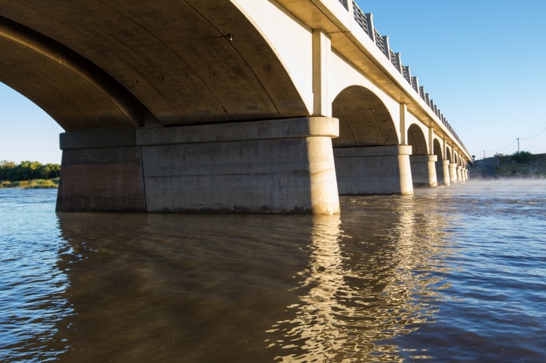
A detailed hydrological and hydraulic assessment of the complex Lower Orange River system undertaken by specialists from the University of Pretoria concluded that these bridges would need to be widened. Raising and widening the three bridges had to comply with heritage requirements, as the structures have significant historical importance. Accordingly, an in-depth heritage study, which formed part of the environmental authorization process, was performed on the structures.
Two of these bridges, consisting of multiple arch structures with six and three spans respectively, were raised by approximately 8 feet (2.5 meters) to prevent structure overtopping during larger flood events. The other, a ten-span arch bridge, was not required to be raised for similar flood events, so the existing deck was retained and widened in its current position. The extent of the widening of the three arch bridges was significant and required an additional overall bridge width of 25.5 feet (8.7 meters) to obtain the proposed width of 40 feet (12.4 meters).
AECOM’s team of experts upgraded a vital transportation link and enhanced the lives of the people to whom this road serves as a lifeline.